Pipeline Validation: Leak Detection
At IntelliFlux Controls, I designed the Pipeline Validation and Leak Detection tool, a GIS-integrated application for utilities to validate hydraulic models, detect leaks, and monitor water distribution networks. The tool merges real-world geospatial maps with hydraulic simulation data, enabling both control-room engineers and field operators to pinpoint anomalies and ensure system efficiency.
Problem
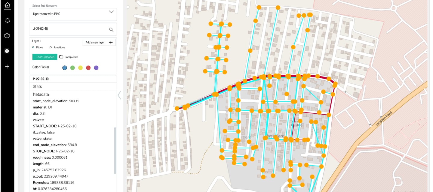
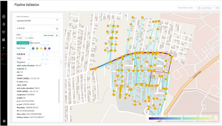
Pipeline networks generate massive, complex datasets — flow rates, elevations, valve states, pressures, and more. Existing validation workflows were slow, fragmented, and required heavy manual effort. The challenge was to design a tool that: Clearly visualized pipes, junctions, and nodes on a map, validated hydraulic models against live or uploaded data, surfaced technical parameters in a way that was digestible and actionable, supported both control-room monitoring and field-based validation.
Solution
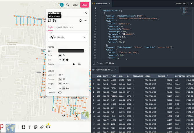
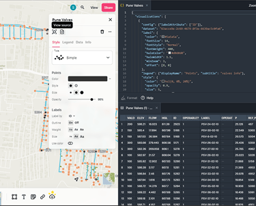
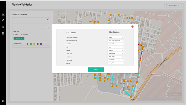
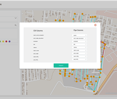
Conducted research with utility engineers and operators, who emphasized the difficulty of correlating CSV-based simulation data with real pipeline maps. Designed and executed GIS integration with developers and refined usability. Interactive Map: Pipelines displayed with flow-based color gradients; junctions and nodes marked for clarity. Metadata Panel: Auto-updates with technical parameters (e.g., node elevation, roughness, Reynolds number, flow rate). Layer Controls: Users toggle pipes, junctions, and sub-networks for focused analysis. CSV Import: Quick model-to-field validation with visual overlays. Leak Detection Workflow: Operators can isolate node ranges, apply filters, and visualize anomalies in context.
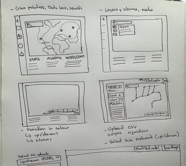
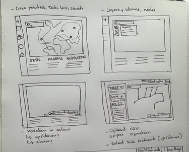
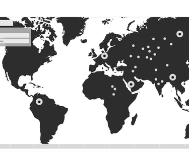
Early Mockups
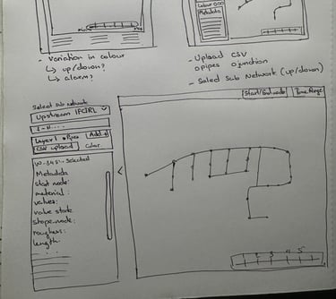
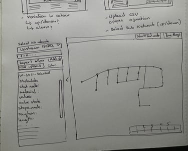
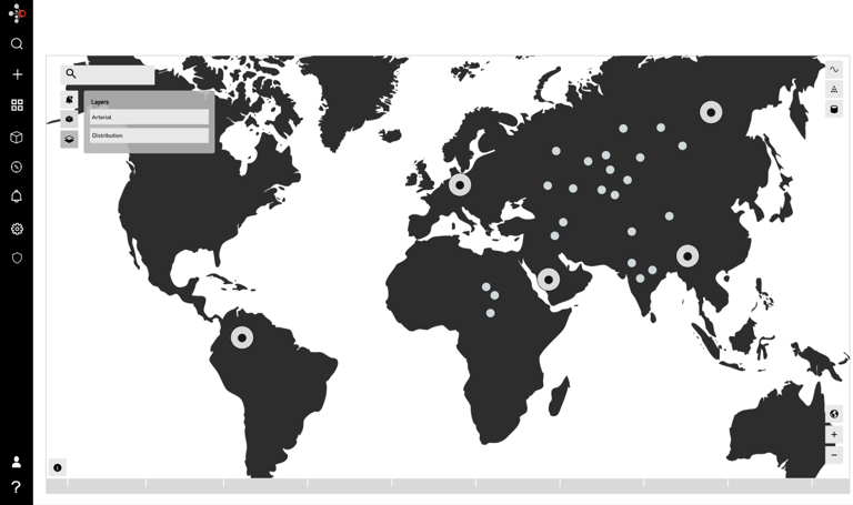
Low-Fidelity
High-Fi and tested on Felt
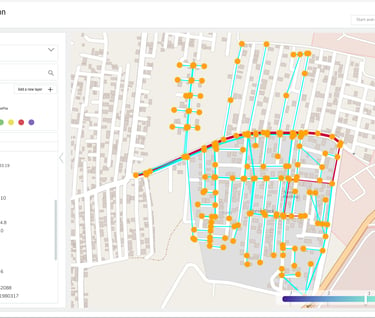
Final Version on APRICOT Portal
Outcomes
The Pipeline Validation tool streamlined pipeline management by merging engineering data, GIS mapping, and automation logic into a single, intuitive platform. Operators could now: validate hydraulic models directly on the map, detects and investigates leaks faster using visual overlays, import and compare simulation results seamlessly, access actionable insights both in the control room and in the field. This impact reduced pipeline validation cycles from days to hours, improved operator confidence by tying data directly to Geo-spatial maps. enabled utilities to detect leaks faster, saving costs and minimizing water loss, extended IntelliFlux’s platform to support asset management and distribution reliability in the utilities sector.
Contacts
winsandyoo@gmail.com